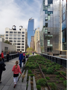
On a recent trip to New York City I visited the High Line, a 1.5 mile-long former elevated railway line built in 1934 to carry goods to and from Manhattan’s largest industrial district. Its elevated position allowed trains to load and unload their cargo inside buildings, without disturbing road traffic. The last train ran along the railway in 1980, leaving its obsolete infrastructure standing above the Meatpacking and Chelsea Districts of the city. It was envisaged that the structure would be demolished and indeed that was the call from local property owners in the 1980s. However the structure was not demolished and in 1999, in true
Jane Jacobs’ style, ‘Friends of the High Line’ was founded by Joshua David and Robert Hammond
[1], residents of the High Line neighbourhood, to advocate the High Line’s preservation and re-use as public open space. The inspiration was the Promenade Plantée in Paris, an elevated linear park built on top of obsolete railway infrastructure in Paris which opened in 1993.
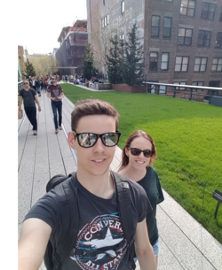
Local support for the retention of the line grew and in 2004, the New York City government - spearheaded by the new business savvy mayor Michael Bloomberg - committed $50 million to help establish the proposed park. Construction began in 2006, with the design being led by landscape architect
James Corner Field Operations. Whilst the initial idea was not that of urban planners, the project and the regeneration of the area were boosted by designation in June 2005 as the
‘The West Chelsea Special District’ by City planners - no doubt influenced by Bloomberg. This designation assisted in unlocking opportunities for new residential and commercial development, as well as facilitating the reuse of the High Line as a unique park and thoroughfare. The designation also set out regulations to ensure the preservation of light, air and views around the High Line so as to maintain the openness of the space.
[2]
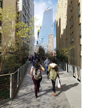
 Today, the High Line is a hive of activity, not only a valuable public open space for local residents but a tourist attraction in its own right, especially for an urban planner like me! The public park weaves itself around and underneath high rise buildings and above the busy car-dominated streets below. There is even an amphitheatre looking down at the traffic on 10th The landscaping is brilliantly
  designed and combines vegetation with remnants of, and references to the old railway, to create a truly fascinating sense of place.
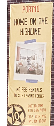
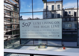
Whilst walking along the route I couldn’t help noticing the scale and intensity of development taking place alongside the route and the fact that the High Line is being used as an unique selling point for a number of schemes. It became clear that the public open space attracts high density, private development and that homes in close proximity to the asset are using the High Line to justify higher house prices.
For a project that cost approximately $260 million to build, it is estimated that tax revenues from the impact of the High Line due to new development and increased local property values was $900 million over a 20 year period[3]. An additional $2 billion in new economic activity[4] is attributed to the High Line. On top of this, millions of tourists (7.6 million in 2015[5]) visit the park every year and spend money in the local area. The public open space is clearly an economic success. Interestingly, the delivery of the project was financed by a combination of public funds, money raised by the ‘Friends of the High Line’ group (including monetary gifts from wealthy backers) as well as finance from a planning obligation-style deal that allowed developers at three sites to build additional floors in exchange for improvements[6] (to the value of $22 million) to the High Line. Whilst walking along the route I couldn’t help noticing the scale and intensity of development taking place alongside the route and the fact that the High Line is being used as an unique selling point for a number of schemes. It became clear that the public open space attracts high density, private development and that homes in close proximity to the asset are using the High Line to justify higher house prices.
Wh
at Joshua David and Robert Hammond have done (with the help of some imaginative and persuasive residents, wealthy financial backers and New York City planners) is to successfully rethink the notion of traditional public open space by reusing leftover railway infrastructure. There is most definitely a lesson to be learnt for councils, developers and built environment professionals in the UK that public open space doesn’t have to be a swing, slide and roundabout and that open space doesn’t have to adhere to strict regulations such as the commonly-used FIT Standards in order to be successful. Similar schemes are now emerging across London such as the
Peckham Coal Line,
Southwark Low Line and
Camden High Line suggesting that local authorities are starting to understand the benefits of alternative forms of open space.
The notion of public open space is often thought of in the traditional sense as a play area or a playing field. However as shown in New York City, public open space can be inherently different and when done well can act as a key catalyst for positive change. It can have a substantial positive impact on the economy, in parallel with the more obvious social and environmental benefits that are normally derived from open spaces.
 On a recent trip to New York City I visited the High Line, a 1.5 mile-long former elevated railway line built in 1934 to carry goods to and from Manhattan’s largest industrial district. Its elevated position allowed trains to load and unload their cargo inside buildings, without disturbing road traffic. The last train ran along the railway in 1980, leaving its obsolete infrastructure standing above the Meatpacking and Chelsea Districts of the city. It was envisaged that the structure would be demolished and indeed that was the call from local property owners in the 1980s. However the structure was not demolished and in 1999, in true Jane Jacobs’ style, ‘Friends of the High Line’ was founded by Joshua David and Robert Hammond[1], residents of the High Line neighbourhood, to advocate the High Line’s preservation and re-use as public open space. The inspiration was the Promenade Plantée in Paris, an elevated linear park built on top of obsolete railway infrastructure in Paris which opened in 1993.

 Local support for the retention of the line grew and in 2004, the New York City government - spearheaded by the new business savvy mayor Michael Bloomberg - committed $50 million to help establish the proposed park. Construction began in 2006, with the design being led by landscape architect
  Today, the High Line is a hive of activity, not only a valuable public open space for local residents but a tourist attraction in its own right, especially for an urban planner like me! The public park weaves itself around and underneath high rise buildings and above the busy car-dominated streets below. There is even an amphitheatre looking down at the traffic on 10th The landscaping is brilliantly
  designed and combines vegetation with remnants of, and references to the old railway, to create a truly fascinating sense of place.
 at Joshua David and Robert Hammond have done (with the help of some imaginative and persuasive residents, wealthy financial backers and New York City planners) is to successfully rethink the notion of traditional public open space by reusing leftover railway infrastructure. There is most definitely a lesson to be learnt for councils, developers and built environment professionals in the UK that public open space doesn’t have to be a swing, slide and roundabout and that open space doesn’t have to adhere to strict regulations such as the commonly-used FIT Standards in order to be successful. Similar schemes are now emerging across London such as the