The Welsh Government’s (WG) delayed
draft Technical Advice Note 15: Development, flooding and coastal erosion and
Consultation Document have now been published. It follows consultation on the draft National Strategy for Flood and Coastal Erosion Risk Management earlier this summer.
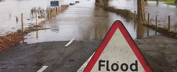
The impacts of flooding can be catastrophic to individuals, communities, businesses, the economy and to the natural and built environment. The effects of climate change cannot be denied and the evidence suggests that future fluvial and coastal flood events are likely to be more frequent and will present greater risks to us and to the environment.
Our understanding of these changes and the risks has evolved since TAN15 was originally published 15 years ago. There has been no change as to how flooding is considered in policy since it was first published. Whilst in the last 18 months clarification has been made on the application of the justification test for highly vulnerable uses, flood classifications and assessment has remained untouched.
The publication of draft TAN15 follows a
report (December 2018), prepared by JBA for the WG, on the performance of the existing TAN. JBA’s view was that when originally published the TAN was ‘ground-breaking’ in introducing flood zones and taking a precautionary approach. However, JBA concluded that due to technical advancements in understanding flood risk and management TAN15 ought to be reviewed. In particular, JBA recommended that TAN15 should: move from the precautionary approach to a risk-based assessment, to capture the sources of all flood risk including surface water flooding, to review the 4 tier Development Advice Maps that we use today and to provide an increased focus on assessing flood risk during development plan preparation and the making of site allocations. It also considered that the strong presumption against highly vulnerable developments in areas of greatest flood risk should remain.
In our June
Planning News, we reported anecdotal comments which suggested that the emerging changes would take a more restrictive approach to developments within DAM Zone C2. Having now seen the draft TAN, it is clear that it’s not only Zone C2 where WG wants to take a more restrictive approach.
Here is a summary of some of the proposed changes:
1. A Wales Flood Map (WFM) will replace Development Advice Maps (DAMs). There will be three flood zones:
- 1 – Very low risk (less than 1 in 1000 year),
- 2 – Low risk (less than 1 in 100 but greater than 1 in 1000 year),
- 3 – Medium and high risk (greater than 1 in 100 year).
The draft states that the WFMs will be the starting point for consideration of risk.
2. There will remain three categories of vulnerability of uses: highly vulnerable, less vulnerable and water compatible. Highly vulnerable uses will continue to include houses, caravans, schools, hospitals and vulnerable industrial e.g. power plants etc. The former emergency services category will become part of the highly vulnerable group and other than police stations etc they will also include buildings used as emergency shelters in times of flood (e.g. some leisure centres). The list of example uses for each category are greater and it’s made clear that any uses not listed are to be determined by professional judgment.
3. Where a mix of uses are accommodated in a single building the vulnerability will be defined by the most vulnerable use. For larger developments with multiple buildings a single vulnerability category may not be appropriate and there will be some flexibility in how the vulnerability classifications can be applied e.g. in relation to proposed developments for housing and open space.
4. In terms of the how the flood risks will be applied:
- In Zone 1 all vulnerabilities of use will be acceptable in principle provided that there is no increase in flooding elsewhere and flood resistant and resilient design in locally defined areas of future or current flood risk are included.
- In Zone 2 all vulnerabilities of use may be acceptable in principle but the proposal must pass a justification test and a series of consequences criteria will need to be met (e.g. evacuation, no increased risk of flooding elsewhere etc).
- In Zone 3 no highly vulnerable development will be considered acceptable. The draft is explicit that FCAs should not be prepared for such uses and there will be no requirement for NRW to respond. Less vulnerable and water compatible uses may be acceptable subject to a separate justification test and a series of criteria on the acceptability of the consequences.
5. Looking at those justification tests in more detail:
- For Zone 2, the site will need to be in an area benefitting from flood defences OR must be part of a local authority initiative to sustain an existing settlement and is identified in an adopted Development Plan which has been prepared using a Strategic Flood Consequences Assessment (SFCA). Critically, to be acceptable in Zone 2, the development will also need to meet the definition of previously developed land. So, essentially, any development in flood zone 2 must be on brownfield land.
- The justification test for Zone 3 (for less vulnerable development, essential transport and utilities infrastructure) requires that the scheme be allocated or be part of an allocation or be identified in an adopted Development Plan i.e. Development in Zone 3 is essentially plan-led and the draft states that such development is a ‘last resort’.
6. The draft recognises that due to industrial legacy there are places in need of major regeneration in areas at risk of flooding. Decisions to enable large scale regeneration of population areas at risk of flooding should be taken through the NDF and SDP.
7. SFCAs should be undertaken as part of the plan-making process although these may be cross boundary assessments to better understand risks across river catchments. Development Plans must also be based on a sound understanding of the Emergency Services’ ability to respond.
8. TAN14 (Coastal planning) will be cancelled and coastal erosion will be dealt with in TAN15. The draft states that development should be avoided where there is a risk of it being impacted by coastal erosion over the lifetime of the development. Zones of development and no development should be identified in the LDP although acceptable uses can also be identified in the LDP.
Commentary
It seems that there are a few critical points arising from the consultation:
1. It’s not yet clear on the extent of zone designations for a particular site or area compared with current mapping. The DAMs were not solely connected to NRW’s own flood risk mapping and the new maps will include a central climate change allowance. Proposals will need to demonstrate the acceptability of the proposal using a range of scenarios including upper limits. Until we have the maps it’s almost impossible to predict what the changes will mean for individual projects.
2. WG is pushing the planning system further towards a previously developed land and plan-led approach to development. Whilst national planning policy already focuses on these it has hitherto not entirely removed the realistic potential for development to come forward by other means e.g windfall development. The emerging TAN could be seen as putting up hurdles to certain development (such as housing and tourist accommodation). The preparation of local development plans is not a quick process and there have been more than a few instances where plans have stalled, gone back to the drawing board, been withdrawn and/or have taken years to adopt. There have also been concerns regarding the lack of delivery against strategic growth requirements in plans that have been adopted.
3. Historically towns have grown around coastal and river locations – some of these are in significant need of regeneration. The draft TAN proposes mechanisms to facilitate windfall development in less and highly vulnerable development in such towns falling under Zone 2 and it creates a framework for development in such areas falling under Zone 3.
4. There is no mention of how the WFM might be challenged if the data used to inform the zoning is found to be inaccurate.
5. Draft TAN15 and the National Strategy had originally been due for consultation together. For reasons unknown the TAN was published late – but not late enough for the consultation responses to the National Strategy to have been digested by WG and to inform the draft TAN.
There are no easy decisions to make when it comes to flood risk and it’s even more difficult when different sides of sustainability are in tension with one another. It is important, indeed, in some instances, it is vital, that there are measures to protect areas at risk of flooding. However, until the WFMs are published it is unclear what impact the approach proposed in the consultation documents will have on achieving sustainable development (under all measures) if the TAN is adopted as drafted.
The consultation of draft TAN15 closed on 17 January 2020.